Directions to Zuma Beach Complete Transportation Guide
Getting to Zuma Beach is straightforward once you know the best routes and current transportation options. Located approximately 35-40 miles from downtown Los Angeles, this spectacular beach offers easy access via Pacific Coast Highway, though travel times can vary significantly based on traffic conditions and your starting location.
GPS Coordinates and Address
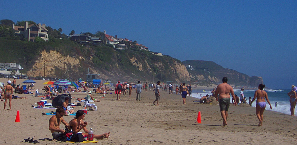
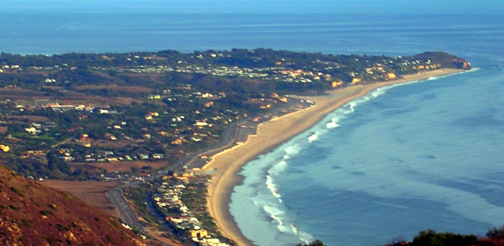
Zuma Beach Address: 30000 Pacific Coast Highway, Malibu, CA 90265
GPS Coordinates: 34.0156° N, 118.8225° W
Navigation Tips: Most GPS systems and mapping apps work well for Zuma Beach. Simply enter "Zuma Beach" or the Pacific Coast Highway address. The beach is clearly marked with signs visible from both directions on PCH.
Driving Directions from Major Areas
From Downtown Los Angeles (35-40 miles, 1-1.5 hours)
Primary Route via I-10 West:
- Take I-10 West from downtown LA toward Santa Monica
- Continue on I-10 West for approximately 15 miles to the end in Santa Monica
- Merge onto Pacific Coast Highway (CA-1) North
- Follow PCH North through Pacific Palisades, past Will Rogers State Beach
- Continue on PCH for approximately 20 miles through Malibu
- Zuma Beach will be on your right (ocean side) with clearly marked parking areas
- Guides
Alternative Scenic Route: Take Sunset Boulevard west to Pacific Coast Highway, then north to Zuma Beach. This route takes slightly longer but offers beautiful views through residential areas and canyons.
From LAX Airport (25 miles, 45 minutes to 1.5 hours)
Fastest Route:
- Exit LAX and head north on Sepulveda Boulevard
- Take I-405 North for about 5 miles
- Exit onto I-10 West toward Santa Monica
- Follow I-10 West to Pacific Coast Highway
- Take PCH North to Zuma Beach
- Guides
Airport Traffic Considerations: LAX area traffic can be extremely heavy, especially during peak travel times. Allow extra time during morning rush (7-9 AM) and evening rush (4-7 PM) hours.
From Hollywood/West Hollywood (30 miles, 1-1.25 hours)
Via Sunset Boulevard:
- Take Sunset Boulevard west from Hollywood
- Continue on Sunset through Beverly Hills, Brentwood, and Pacific Palisades
- At the Pacific Coast, Sunset becomes PCH
- Follow PCH North to Zuma Beach
- Guides
Via Canyon Routes: Several canyon roads including Topanga Canyon Boulevard and Malibu Canyon Road connect the San Fernando Valley to PCH. These routes can be faster during heavy coastal traffic but involve winding mountain roads.
From Orange County (60-80 miles, 1.5-2.5 hours)
Northern Route:
- Take I-405 North through Los Angeles
- Exit onto I-10 West toward Santa Monica
- Follow directions from downtown LA (above)
- Guides
Coastal Route: Take Pacific Coast Highway north through Long Beach, Palos Verdes, and Santa Monica. This scenic route takes longer but offers continuous ocean views.
From San Fernando Valley (25-35 miles, 45 minutes to 1.5 hours)
Via Topanga Canyon:
- Take Topanga Canyon Boulevard south from the 101 Freeway
- Follow the winding road through the Santa Monica Mountains
- At Pacific Coast Highway, turn right (north) toward Malibu
- Continue on PCH to Zuma Beach
- Guides
Via Malibu Canyon: Take Las Virgenes Road/Malibu Canyon Road south from the 101 Freeway to PCH, then north to Zuma Beach.
Traffic Patterns and Best Times to Travel
Peak Traffic Times to Avoid:
- Weekday morning rush: 7:00-9:30 AM
- Weekday evening rush: 4:00-7:00 PM
- Weekend beach traffic: Saturday and Sunday 10 AM-2 PM (arriving) and 4-7 PM (departing)
- Summer weekends can be particularly congested
- Guides
Best Travel Times:
- Weekday mid-morning: 9:30 AM-11:00 AM
- Early morning: Before 8:00 AM on weekends
- Late afternoon: After 7:00 PM for sunset visits
- Weekdays generally have lighter traffic than weekends
- Guides
Public Transportation (2025 Updates)
Current Transit Challenges: Public transportation to Zuma Beach has been significantly impacted by the January 2025 Palisades Fire recovery efforts. Metro Line 134, which previously provided bus service from Santa Monica to Malibu, currently has a 10-mile service gap on Pacific Coast Highway.
Limited Service Available:
- Metro Line 134 operates with gaps between Temescal Canyon and Rambla Vista
- The closest accessible stop is at Trancas Canyon & Pacific Coast Highway
- From Trancas Canyon, visitors must walk approximately 1 mile to reach Zuma Beach
- Service operates Monday through Friday with limited weekend service
- Guides
Alternative Transit Route:
- Take Metro Expo Line to Culver City Station
- Transfer to Metro Line 134 (where service is available)
- Plan for gaps in service and potential walking distances
- Always verify current service status before traveling
- Guides
Ride-Sharing and Taxi Services: Uber, Lyft, and traditional taxi services operate to Zuma Beach, though costs can be significant due to distance. Expect prices to increase during peak beach times and surge pricing periods.
Parking Information
Parking Lot Locations: Zuma Beach features eight large parking lots with over 2,000 parking spaces total. Lots are numbered and clearly marked along Pacific Coast Highway.
Current Parking Rates (2025):
- Parking meters: $0.50 per 15 minutes (90-minute maximum)
- Daily parking rates: $8-$20 depending on season and day of week
- Peak season rates are higher than off-season rates
- Payment accepted: Credit cards, debit cards, and mobile payment apps
- Guides
Parking Tips:
- Arrive early during summer weekends for the best parking availability
- Lots closest to lifeguard towers fill up first
- North parking lots often have more availability than central lots
- Consider walking from less crowded lots for exercise and easier parking
- Guides
No Overnight Parking: Overnight parking is strictly prohibited at all LA County beaches, including Zuma Beach. Vehicles left overnight may be cited and towed.
Alternative Routes During Heavy Traffic
Inland Canyon Routes: When Pacific Coast Highway is heavily congested, consider these mountain routes:
- Topanga Canyon Boulevard: Connects PCH to the 101 Freeway via winding mountain roads
- Malibu Canyon Road: Las Virgenes Road connects Agoura Hills area to PCH
- Decker Canyon Road: Northern route connecting Westlake Village area to PCH
- Guides
Important Canyon Route Considerations:
- Roads are narrow and winding with steep grades
- Not recommended for large vehicles or RVs
- Can be closed during fire weather or emergency conditions
- May take longer than PCH during normal traffic conditions
- Guides
Navigation and Mapping Apps
Recommended Apps:
- Google Maps: Provides real-time traffic updates and alternative route suggestions
- Waze: Community-reported traffic, accidents, and road closures
- Apple Maps: Integrates well with iOS devices and provides accurate directions
- Beach-specific apps: Some apps provide beach conditions and parking availability
- Guides
Pro Navigation Tips:
- Download offline maps in case of poor cell service in canyon areas
- Set your destination before starting to drive for safety
- Check for road closures, especially during fire season
- Consider traffic patterns when planning your departure time
- Guides
Accessibility and Special Transportation Needs
Accessible Parking: Designated accessible parking spaces are available throughout Zuma Beach parking areas, located close to beach access points and restroom facilities.
Wheelchair Access: The beach provides wheelchair-accessible pathways from parking areas to the sand, as well as accessible restroom facilities and water fountains.
Public Transportation Accessibility: Metro buses are equipped with wheelchair lifts and priority seating. However, the current service gaps may create accessibility challenges for users depending on public transit.
Emergency and Safety Considerations
Cell Phone Coverage: Most areas along the route to Zuma Beach have good cell phone coverage, though some canyon routes may have spotty service.
Emergency Services: Pacific Coast Highway is well-patrolled by California Highway Patrol and LA County Sheriff's Department. Emergency services are readily available throughout the route.
Road Conditions: Check current road conditions, especially during winter months when rain can cause mudslides or flooding in canyon areas. Fire season may also affect road access.
Fuel and Services Along the Route
Gas Stations: Multiple gas stations are available along Pacific Coast Highway, though prices tend to be higher in Malibu than in other areas. Fill up before reaching the beach to save money.
Food and Supplies: Several shopping centers along PCH offer restaurants, grocery stores, and beach supply shops for last-minute needs.
Rest Stops: Public restrooms and rest areas are available at various points along Pacific Coast Highway, including state beaches and recreational areas.
Seasonal and Weather Considerations
Summer Traffic: Expect heavy traffic during summer months (June through September), especially on weekends. Plan for significantly longer travel times during peak beach season.
Fog and Visibility: Coastal fog can reduce visibility, especially during early morning hours and late spring months. Drive cautiously and use headlights when visibility is reduced.
Fire Season Impact: During fire season (typically October through December), road closures may affect access routes. Monitor current conditions and have alternative route plans.
Rain and Winter Conditions: Winter storms can cause rockslides and flooding on canyon roads. Check weather and road conditions before traveling during rainy periods.